ملف:Sudan adm location map.svg

الملف الأصلي (ملف SVG، أبعاده 1٬654 × 1٬450 بكسل، حجم الملف: 251 كيلوبايت)
| هذا ملف من ويكيميديا كومنز. معلومات من صفحة وصفه مبينة في الأسفل. كومنز مستودع ملفات ميديا ذو رخصة حرة. |
ملخص
| الوصف |
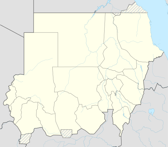
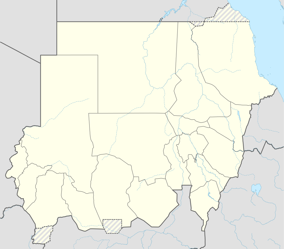
Deutsch: Positionskarte von Sudan
English: Location map of Sudan
|
||||||||||||
| التاريخ | |||||||||||||
| المصدر |
Own work using:
|
||||||||||||
| المؤلف | NordNordWest | ||||||||||||

|
أُنتجت هذه الخريطة أو حُسِّنت في مَرسم الخرائِط الأَلمانيُّ. يُمكنك أَيضاً اقتراح خرائِطَ أُخرى للتحسين.
|
ترخيص
Usage of this file with:

explanatory notes: Legally binding is only the full legalcode. For a free usage I recommend to respect the following licence conditions:
1. Provide my name as given above: NordNordWest,
2. a copy of, or the URI for, the applicable license: https://creativecommons.org/licenses/by-sa/3.0/de/legalcode,
3. the title of the work,
4. in the case of an adaptation, a credit identifying the use of the work in the adaptation.
This license and the rights granted hereunder will terminate automatically upon any breach by you of the terms of this license. Any of the above conditions can be waived if you get permission from the copyright holder. If you have questions or wish differing conditions, please contact me through nnwest or my discussion page ![]() t-online.de
t-online.de
- يحقُّ لك:
- مشاركة العمل – نسخ العمل وتوزيعه وبثُّه
- إعادة إنتاج العمل – تعديل العمل
- حسب الشروط التالية:
- نسب العمل إلى مُؤَلِّفه – يلزم نسب العمل إلى مُؤَلِّفه بشكل مناسب وتوفير رابط للرخصة وتحديد ما إذا أجريت تغييرات. بالإمكان القيام بذلك بأية طريقة معقولة، ولكن ليس بأية طريقة تشير إلى أن المرخِّص يوافقك على الاستعمال.
- الإلزام بترخيص المُشتقات بالمثل – إذا أعدت إنتاج المواد أو غيرت فيها، فيلزم أن تنشر مساهماتك المُشتقَّة عن الأصل تحت ترخيص الأصل نفسه أو تحت ترخيص مُتوافِقٍ معه.

تاريخ الملف
اضغط على زمن/تاريخ لرؤية الملف كما بدا في هذا الزمن.
| زمن/تاريخ | صورة مصغرة | الأبعاد | مستخدم | تعليق | |
|---|---|---|---|---|---|
| حالي | 11:05، 25 مارس 2015 | | 1٬654 × 1٬450 (251 كيلوبايت) | NordNordWest | upd |
| 18:07، 12 نوفمبر 2014 |  | 1٬654 × 1٬450 (251 كيلوبايت) | NordNordWest | == {{int:filedesc}} == {{Information |Description= {{de|1=Positionskarte von Sudan}} {{en|1=Location map of Sudan}} {{Location map series N |stretching=103 |top=23.3 |bottom=8.4 |left=21.5 |right=39.0 }} |Source={{Own using}} * United States National I... |
استخدام الملف
ال6 صفحات التالية تستخدم هذا الملف:
الاستخدام العالمي للملف
الويكيات الأخرى التالية تستخدم هذا الملف:
- الاستخدام في af.wikipedia.org
- الاستخدام في an.wikipedia.org
- الاستخدام في arz.wikipedia.org
- الاستخدام في ast.wikipedia.org
- الاستخدام في azb.wikipedia.org
- ام درمان
- کادوقلی
- نیاله
- شندی (سودان)
- دلنج
- الدبه، سودان
- بور سودان
- کتم
- کسلا
- عبری، سودان
- سواکن
- القضارف
- الجنینه
- الروصیرص
- الدمازین
- الفاشر
- بربر، سودان
- وادی حلفا
- سنار (سودان)
- الدامر
- کرمک، سودان
- دنقلا
- عطبره (سودان)
- القطینه
- ام بادر
- الضعین
- سنجه (سودان)
- کریمه، سودان
- هیا، سودان
- شواک
- الجبلیان
- بابنوسه
- طوکر
- ابو حامد
اعرض المزيد من الاستخدام العام لهذا الملف.