ملف:Yugoslavia map norwegian.svg

الملف الأصلي (ملف SVG، أبعاده 595 × 431 بكسل، حجم الملف: 315 كيلوبايت)
| هذا ملف من ويكيميديا كومنز. معلومات من صفحة وصفه مبينة في الأسفل. كومنز مستودع ملفات ميديا ذو رخصة حرة. |
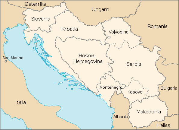
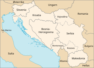
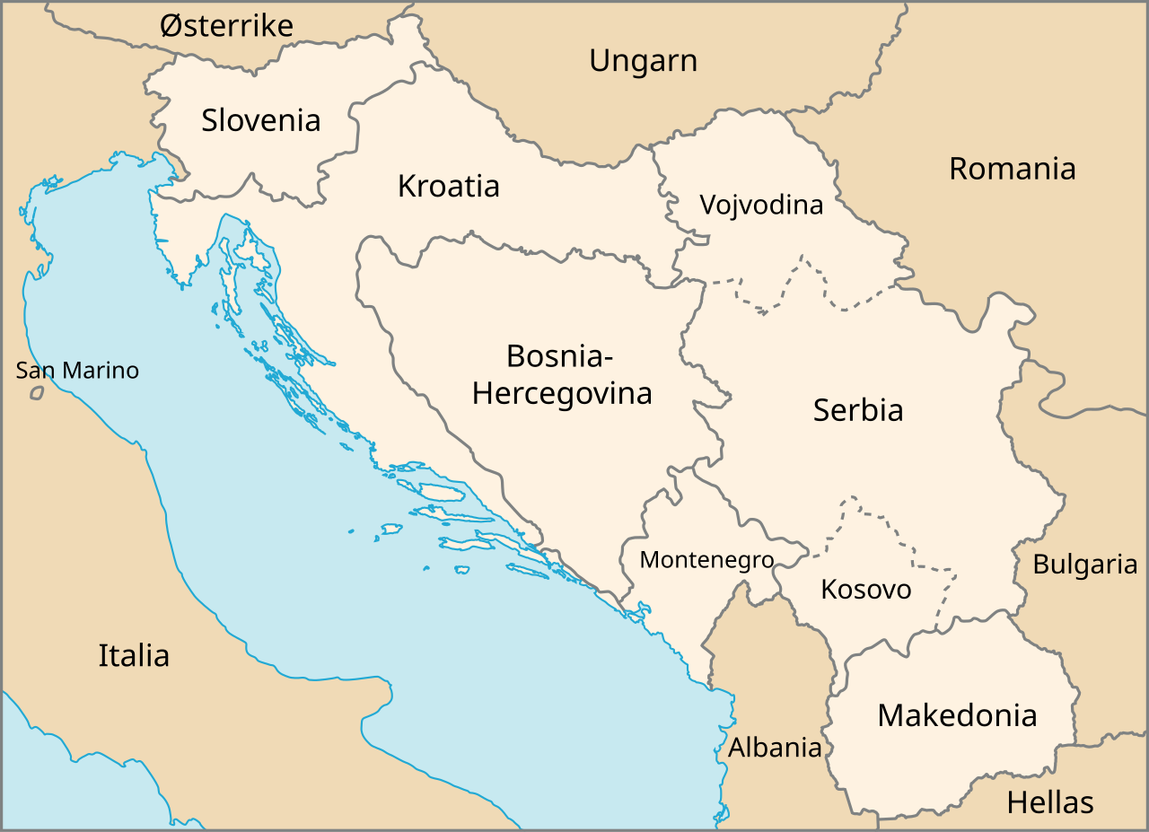
| الوصف | Map of The Former Yugoslavia in Norwegian | |||
| التاريخ | February, 2003 (created), February, 2007 (edited) | |||
| المصدر | http://www.un.org/Depts/Cartographic/map/profile/frmryugo.pdf | |||
| المؤلف | Department of Public Information Cartographic Section, edited by Stian H. | |||
| الترخيص (إعادة استخدام هذا الملف) |
|

تاريخ الملف
اضغط على زمن/تاريخ لرؤية الملف كما بدا في هذا الزمن.
| زمن/تاريخ | صورة مصغرة | الأبعاد | مستخدم | تعليق | |
|---|---|---|---|---|---|
| حالي | 17:29، 19 فبراير 2007 | | 595 × 431 (315 كيلوبايت) | Stianbh | {{Information| |Description=Map of The Former Yugoslavia in Norwegian |Source=http://www.un.org/Depts/Cartographic/map/profile/frmryugo.pdf |Date=February, 2003 (created), February, 2007 (edited) |Author=Department of Public Information Cartographic Secti |
استخدام الملف
لا توجد صفحات تستخدم هذا الملف.
الاستخدام العالمي للملف
الويكيات الأخرى التالية تستخدم هذا الملف:
- الاستخدام في fi.wikipedia.org
- الاستخدام في nn.wikipedia.org
- الاستخدام في no.wikipedia.org