ملف:Un-guatemala.png
الملف الأصلي (2٬493 × 2٬947 بكسل حجم الملف: 1٫8 ميجابايت، نوع MIME: image/png)
| هذا ملف من ويكيميديا كومنز. معلومات من صفحة وصفه مبينة في الأسفل. كومنز مستودع ملفات ميديا ذو رخصة حرة. |
| This image is a map derived from a United Nations map.
Unless stated otherwise, UN maps are to be considered in the public domain. This applies worldwide. UN maps are, in principle, open source material and you can use them in your work or for making your own map. UN requests however that you delete the UN name, logo and reference number upon any modification to the map. Content of your map will be your responsibility. You can state in your publication, if you wish, something like: based on UN map … (map name, map number, revision number and date). See: Geospatial Information Section. And: Geospatial, location data for a better world. |
 |
| الوصف |
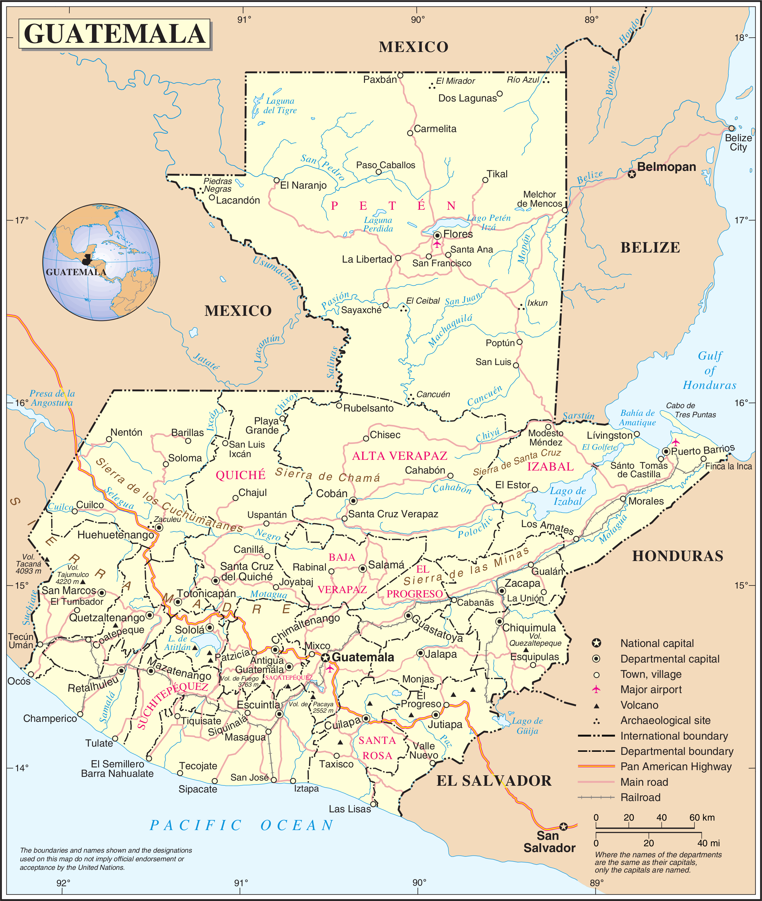
English: Political map of Guatemala generated by the United Nations. |
| التاريخ | |
| المصدر | United Nations Geospatial Information Section |
| المؤلف | United Nations Department of Peacekeeping Operations Cartographic Section |
تاريخ الملف
اضغط على زمن/تاريخ لرؤية الملف كما بدا في هذا الزمن.
| زمن/تاريخ | صورة مصغرة | الأبعاد | مستخدم | تعليق | |
|---|---|---|---|---|---|
| حالي | 01:04، 24 أكتوبر 2007 | | 2٬493 × 2٬947 (1٫8 ميجابايت) | Jeroen | {{UN map}} Category:Maps of Guatemala |
استخدام الملف
الصفحة التالية تستخدم هذا الملف:
الاستخدام العالمي للملف
الويكيات الأخرى التالية تستخدم هذا الملف:
- الاستخدام في af.wikipedia.org
- الاستخدام في be-tarask.wikipedia.org
- الاستخدام في ckb.wikipedia.org
- الاستخدام في el.wikipedia.org
- الاستخدام في en.wikipedia.org
- Geography of Guatemala
- List of places in Guatemala
- Carlos Castillo Armas
- 1954 Guatemalan coup d'état
- Water supply and sanitation in Guatemala
- Outline of Guatemala
- Guatemala
- List of rivers of Guatemala
- Index of Guatemala-related articles
- Water resources management in Guatemala
- United Nations Security Council Resolution 1094
- User:Nlyemica/sandbox
- الاستخدام في es.wikipedia.org
- الاستخدام في fa.wikipedia.org
- الاستخدام في fi.wikipedia.org
- الاستخدام في gom.wikipedia.org
- الاستخدام في id.wikipedia.org
- الاستخدام في kbp.wikipedia.org
- الاستخدام في kn.wikipedia.org
- الاستخدام في lez.wikipedia.org
- الاستخدام في mzn.wikipedia.org
- الاستخدام في nl.wikipedia.org
- الاستخدام في pl.wiktionary.org
- الاستخدام في ro.wikipedia.org
- الاستخدام في ru.wikipedia.org
- الاستخدام في sl.wikipedia.org
- الاستخدام في ta.wikipedia.org
- الاستخدام في te.wikipedia.org
- الاستخدام في to.wikipedia.org
- الاستخدام في uk.wikipedia.org
- الاستخدام في uk.wiktionary.org
- الاستخدام في www.wikidata.org
اعرض المزيد من الاستخدام العام لهذا الملف.