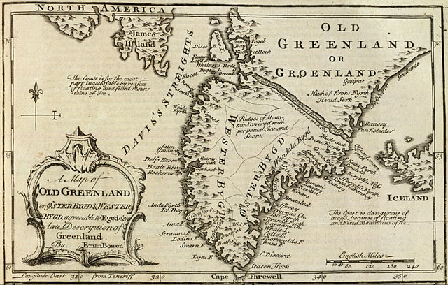
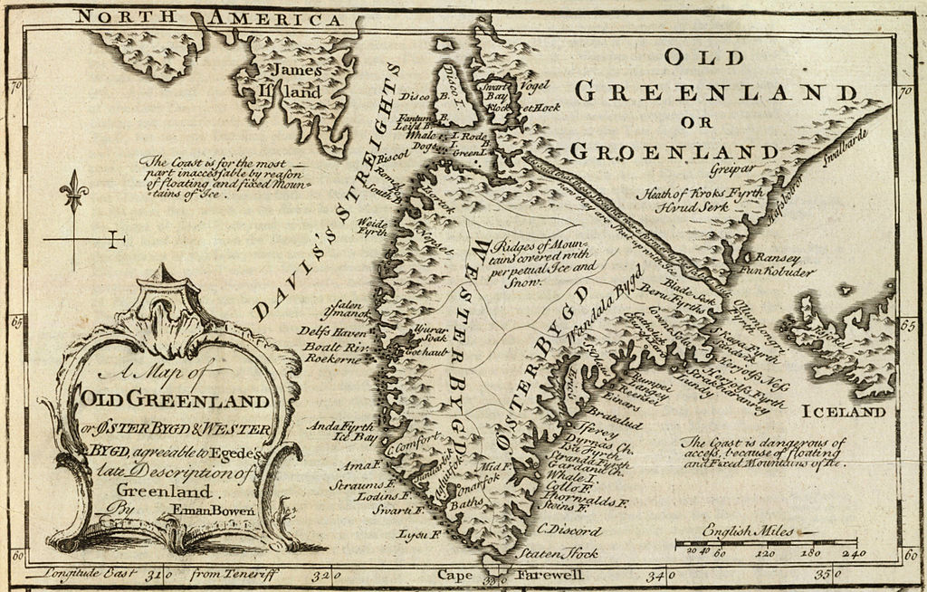
ملف:Old Greenland 1747.jpg

الملف الأصلي (2٬048 × 1٬307 بكسل حجم الملف: 2٫23 ميجابايت، نوع MIME: image/jpeg)
| هذا ملف من ويكيميديا كومنز. معلومات من صفحة وصفه مبينة في الأسفل. كومنز مستودع ملفات ميديا ذو رخصة حرة. |
ملخص
| الوصف |
English: Cropped and rotated from the original.
|
| التاريخ | |
| المصدر | David Rumsey Collection |
| المؤلف | Emanuel Bowen (c. 1694–1767) |
ترخيص
|
هذه الصورة هي إعادة إنتاج خالصة لعمل فني ثنائي الأبعاد وبالتالي فلا يمكن أن يكون لها حقوق نشر وتأليف بنفسها في الولايات المتحدة حسب قضية مكتبة فنون بريدجمان ضد شركة كورل؛ المسألة قانونية أيضاً في العديد من الدول الأخرى، بما في ذلك ألمانيا.
العمل الأصلي ثنائي الأبعاد المعروض في هذه الصورة هو محتوى حر بسبب:
لذا فإنَّ إعادة الإنتاج هذه تخضع أيضاً لنفس الشروط كما هو الحال مع العمل الأصلي.
| ||||
تاريخ الملف
اضغط على زمن/تاريخ لرؤية الملف كما بدا في هذا الزمن.
| زمن/تاريخ | صورة مصغرة | الأبعاد | مستخدم | تعليق | |
|---|---|---|---|---|---|
| حالي | 15:21، 10 مايو 2012 | | 2٬048 × 1٬307 (2٫23 ميجابايت) | LlywelynII |
استخدام الملف
الصفحة التالية تستخدم هذا الملف:
الاستخدام العالمي للملف
الويكيات الأخرى التالية تستخدم هذا الملف:
- الاستخدام في af.wikipedia.org
- الاستخدام في bs.wikipedia.org
- الاستخدام في ca.wikipedia.org
- الاستخدام في ceb.wikipedia.org
- الاستخدام في cs.wikipedia.org
- الاستخدام في da.wikipedia.org
- الاستخدام في en.wikipedia.org
- الاستخدام في es.wikipedia.org
- الاستخدام في fa.wikipedia.org
- الاستخدام في fy.wikipedia.org
- الاستخدام في io.wikipedia.org
- الاستخدام في ko.wikipedia.org
- الاستخدام في pt.wikipedia.org
- الاستخدام في sv.wikipedia.org
- الاستخدام في te.wikipedia.org
- الاستخدام في tr.wikipedia.org
- الاستخدام في uk.wikipedia.org
- الاستخدام في www.wikidata.org
- الاستخدام في zh.wikipedia.org