ملف:North Yorkshire UK location map (1974-2023).svg

حجم معاينة PNG لذلك الملف ذي الامتداد SVG: 800 × 582 بكسل. الأبعاد الأخرى: 320 × 233 بكسل | 640 × 466 بكسل | 1٬024 × 745 بكسل | 1٬280 × 931 بكسل | 2٬560 × 1٬863 بكسل | 1٬425 × 1٬037 بكسل.
الملف الأصلي (ملف SVG، أبعاده 1٬425 × 1٬037 بكسل، حجم الملف: 3٫22 ميجابايت)
| هذا ملف من ويكيميديا كومنز. معلومات من صفحة وصفه مبينة في الأسفل. كومنز مستودع ملفات ميديا ذو رخصة حرة. |
.svg)
| الوصف |
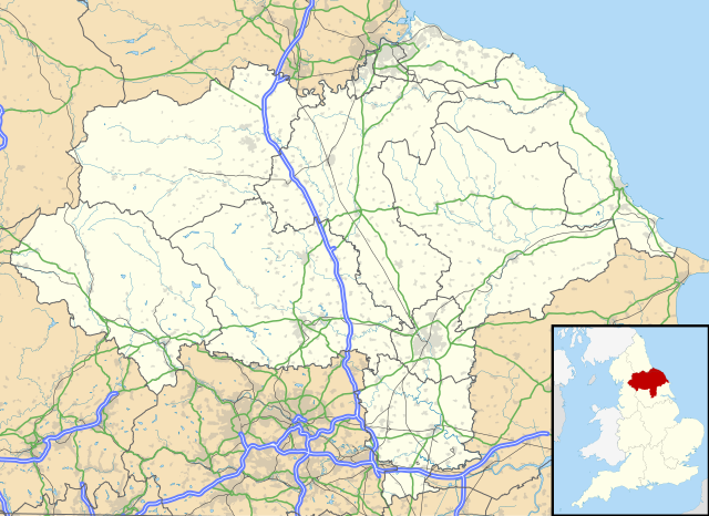
Map of North Yorkshire, UK with the following information shown:
Equirectangular map projection on WGS 84 datum, with N/S stretched 170% Geographic limits:
|
| التاريخ | |
| المصدر |
|
| المؤلف | Nilfanion, created using Ordnance Survey data |
| الترخيص (إعادة استخدام هذا الملف) |
هذا الملفُّ مُرخَّص بموجب رخصة المشاع الإبداعي نسبة المُصنَّف إِلى مُؤَلِّفه - المشاركة بالمثل 3.0 العامة نسب العمل لمُؤَلِّفه: Contains Ordnance Survey data © Crown copyright and database right
|
| إصدارات أخرى | File:North Yorkshire UK district map (blank).svg - Blank map |
.svg)
تاريخ الملف
اضغط على زمن/تاريخ لرؤية الملف كما بدا في هذا الزمن.
| زمن/تاريخ | صورة مصغرة | الأبعاد | مستخدم | تعليق | |
|---|---|---|---|---|---|
| حالي | 20:34، 1 أبريل 2018 | | 1٬425 × 1٬037 (3٫22 ميجابايت) | Nilfanion | Update to A1 -> A1(M), other tweaks |
| 19:07، 26 سبتمبر 2010 |  | 1٬425 × 1٬037 (3٫17 ميجابايت) | Nilfanion | {{Information |Description=Map of North Yorkshire, UK with the following information shown: *Administrative borders *Coastline, lakes and rivers *Roads and railways *Urban areas Equirectangular map projection on WGS 84 datum, with N |
استخدام الملف
الصفحتان التاليتان تستخدمان هذا الملف:
الاستخدام العالمي للملف
الويكيات الأخرى التالية تستخدم هذا الملف:
- الاستخدام في bg.wikipedia.org
- الاستخدام في ceb.wikipedia.org
- الاستخدام في da.wikipedia.org
- الاستخدام في en.wikipedia.org
- الاستخدام في es.wikipedia.org
- York
- Castillo de Howard
- Scarborough
- Ripon
- Middlesbrough
- RAF Fylingdales
- Catedral de York
- Museo de Yorkshire
- Stainforth (Yorkshire del Norte)
- Harrogate
- Plantilla:Mapa de localización de Yorkshire del Norte
- Fulford (Yorkshire del Norte)
- Tunstall (Yorkshire del Norte)
- Abadía de Whitby
- Barlby
- Appletreewick
- Skipton
- Selby
- Northallerton
- Glaisdale
- Cross Hills
- Colburn (Yorkshire del Norte)
- Ampleforth
- Alne
- Cononley
- Cowling
- Appleton Roebuck
- Darley
- Alanbrooke Barracks
- Monk Fryston
- Helperby
- High Bentham
- Hemingbrough
- Austwick
- Embsay
- East Cowton
- Easingwold
- Eggborough
- Escrick
- Bagby
- Hensall
- Hinderwell
- Sheriff Hutton
- Shipton (Yorkshire del Norte)
- South Milford
- Slingsby
اعرض المزيد من الاستخدام العام لهذا الملف.
.svg)
.svg)