ملف:Maricopa County Incorporated and Planning areas Chandler highlighted.svg

حجم معاينة PNG لذلك الملف ذي الامتداد SVG: 694 × 599 بكسل. الأبعاد الأخرى: 278 × 240 بكسل | 556 × 480 بكسل | 889 × 768 بكسل | 1٬185 × 1٬024 بكسل | 2٬371 × 2٬048 بكسل | 940 × 812 بكسل.
الملف الأصلي (ملف SVG، أبعاده 940 × 812 بكسل، حجم الملف: 1٫05 ميجابايت)
| هذا ملف من ويكيميديا كومنز. معلومات من صفحة وصفه مبينة في الأسفل. كومنز مستودع ملفات ميديا ذو رخصة حرة. |
ملخص
| الوصف |
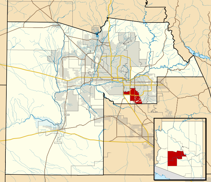
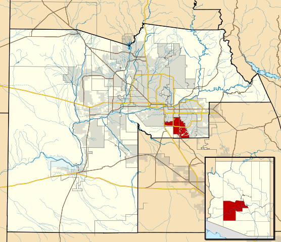
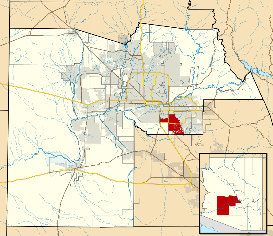
This map shows the incorporated areas and Indian reservation boundaries in Maricopa County, Arizona, along with water bodies and major highways and roads.
|
| التاريخ | |
| المصدر | My own work, based on government information |
| المؤلف | Ixnayonthetimmay |
| الترخيص (إعادة استخدام هذا الملف) |
Public Domain |
| إصدارات أخرى | See Category:Maps of Maricopa County for other versions of this image. |
ترخيص
| أنا، مالِك حقوق تأليف ونشر هذا العمل، أجعله في النِّطاق العامِّ، يسري هذا في أرجاء العالم كلِّه. في بعض البلدان، قد يكون هذا التَّرخيص غيرَ مُمكنٍ قانونيَّاً، في هذه الحالة: أمنح الجميع حق استخدام هذا العمل لأي غرض دون أي شرط ما لم يفرض القانون شروطًا إضافية. |
تاريخ الملف
اضغط على زمن/تاريخ لرؤية الملف كما بدا في هذا الزمن.
| زمن/تاريخ | صورة مصغرة | الأبعاد | مستخدم | تعليق | |
|---|---|---|---|---|---|
| حالي | 06:15، 20 مايو 2011 | | 940 × 812 (1٫05 ميجابايت) | Ixnayonthetimmay | Uploading new version |
| 04:01، 30 أغسطس 2008 |  | 900 × 800 (413 كيلوبايت) | Ixnayonthetimmay | == Summary == {{Information |Description=This map shows the incorporated areas and unincorporated areas in Maricopa County, Arizona. [[:en:Chandler, Arizona| | |
| 23:57، 15 سبتمبر 2007 |  | 900 × 800 (384 كيلوبايت) | Ixnayonthetimmay | ||
| 23:56، 15 سبتمبر 2007 |  | 900 × 800 (384 كيلوبايت) | Ixnayonthetimmay | == Summary == {{Information |Description=This map shows the incorporated areas in Maricopa County, Arizona. It also shows the boundaries for the municipal planning areas. The [[:en:Fort | |
| 09:52، 28 مايو 2007 |  | 900 × 780 (329 كيلوبايت) | Ixnayonthetimmay | ||
| 23:54، 21 مايو 2007 |  | 900 × 780 (318 كيلوبايت) | Ixnayonthetimmay | ||
| 04:55، 30 يناير 2007 |  | 904 × 758 (177 كيلوبايت) | Ixnayonthetimmay | {{Information |Description=This map shows the incorporated areas in Maricopa County, Arizona, highlighting Chandler in red. It also shows the boundaries for the |
استخدام الملف
الصفحة التالية تستخدم هذا الملف:
الاستخدام العالمي للملف
الويكيات الأخرى التالية تستخدم هذا الملف:
- الاستخدام في arz.wikipedia.org
- الاستخدام في br.wikipedia.org
- الاستخدام في ca.wikipedia.org
- الاستخدام في ceb.wikipedia.org
- الاستخدام في de.wikipedia.org
- الاستخدام في el.wikipedia.org
- الاستخدام في eo.wikipedia.org
- الاستخدام في es.wikipedia.org
- الاستخدام في eu.wikipedia.org
- الاستخدام في fi.wikipedia.org
- الاستخدام في fr.wikipedia.org
- الاستخدام في ga.wikipedia.org
- الاستخدام في ht.wikipedia.org
- الاستخدام في hu.wikipedia.org
- الاستخدام في id.wikipedia.org
- الاستخدام في it.wikipedia.org
- الاستخدام في ja.wikipedia.org
- الاستخدام في kw.wikipedia.org
- الاستخدام في mg.wikipedia.org
- الاستخدام في pl.wikipedia.org
- الاستخدام في pt.wikipedia.org
- الاستخدام في ro.wikipedia.org
- الاستخدام في sr.wikipedia.org
- الاستخدام في sv.wikipedia.org
- الاستخدام في sw.wikipedia.org
- الاستخدام في tt.wikipedia.org
- الاستخدام في ur.wikipedia.org
- الاستخدام في vi.wikipedia.org
- الاستخدام في vo.wikipedia.org
- الاستخدام في www.wikidata.org
- الاستخدام في zh.wikipedia.org