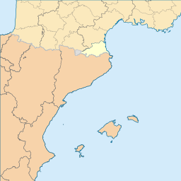
ملف:Mapa de localització als Departament dels Pirineus Orientals.svg

حجم معاينة PNG لذلك الملف ذي الامتداد SVG: 256 × 256 بكسل. الأبعاد الأخرى: 240 × 240 بكسل | 480 × 480 بكسل | 768 × 768 بكسل | 1٬024 × 1٬024 بكسل | 2٬048 × 2٬048 بكسل.
الملف الأصلي (ملف SVG، أبعاده 256 × 256 بكسل، حجم الملف: 629 كيلوبايت)
| هذا ملف من ويكيميديا كومنز. معلومات من صفحة وصفه مبينة في الأسفل. كومنز مستودع ملفات ميديا ذو رخصة حرة. |
| الوصف |
English: Blank administrative map of France for geo-location purpose, with regions and departements distinguished. Approximate scale : 1:3,000,000 Français : Carte administrative vierge de la France destinée à la géolocalisation, avec régions et départements distingués. Equirectangular projection, WGS84 datumÉchelle approximative : 1:3 000 000 *Central meridian: 002° 06' E *True scale parallel: 46° 15' N Geographic limits of the map : *West : 005° 48' W *East : 10° E *North : 51° 30' N *South : 41° N Español: Mapa administrativo en blanco de Francia para fines de geolocalización, con regiones y departamentos distinguidos.
Català: Mapa de les comunitats autònomes d'Espanya.
blank map of Italy, divided in provinces. It can be easily divided even in regions. |
| التاريخ | (UTC) |
| المصدر | |
| المؤلف |
|
هذا الملفُّ مُرخَّص بموجب رخصة المشاع الإبداعي نسبة المُصنَّف إِلى مُؤَلِّفه - المشاركة بالمثل 3.0 العامة
- يحقُّ لك:
- مشاركة العمل – نسخ العمل وتوزيعه وبثُّه
- إعادة إنتاج العمل – تعديل العمل
- حسب الشروط التالية:
- نسب العمل إلى مُؤَلِّفه – يلزم نسب العمل إلى مُؤَلِّفه بشكل مناسب وتوفير رابط للرخصة وتحديد ما إذا أجريت تغييرات. بالإمكان القيام بذلك بأية طريقة معقولة، ولكن ليس بأية طريقة تشير إلى أن المرخِّص يوافقك على الاستعمال.
- الإلزام بترخيص المُشتقات بالمثل – إذا أعدت إنتاج المواد أو غيرت فيها، فيلزم أن تنشر مساهماتك المُشتقَّة عن الأصل تحت ترخيص الأصل نفسه أو تحت ترخيص مُتوافِقٍ معه.
سجلُّ الرَّفع الأصيل
This image is a derivative work of the following images:
- File:France_location_map-Regions_and_departements.svg licensed with Cc-by-sa-3.0,2.5,2.0,1.0, GFDL
- 2009-02-02T16:12:50Z Yug 2000x1922 (772026 Bytes) Restore light style version ; a specific file name will be use for polygon departement maps.
- 2009-02-01T19:34:09Z Yug 2000x1922 (1849428 Bytes) restore East and southern border deleted by mistake + code improving.
- 2009-02-01T14:41:40Z Yug 2000x1922 (1852045 Bytes) Statistic friendly added, as an upper layer.
- 2008-11-07T13:23:10Z Sting 2000x1922 (772026 Bytes) + boundary for Channel Islands
- 2008-08-23T16:29:48Z Sting 2000x1922 (769918 Bytes) Larger strokes for boundaries
- 2008-07-25T17:35:54Z Sting 2000x1922 (770878 Bytes) Display bug
- 2008-07-25T17:28:38Z Sting 2000x1922 (772649 Bytes) Variable scale
- 2008-07-25T14:29:27Z Sting 2000x1922 (773101 Bytes) - border
- 2008-07-25T14:23:11Z Sting 2000x1922 (773214 Bytes) Other countries' color
- 2008-07-04T20:32:47Z Sting 2000x1922 (772973 Bytes) == Summary == {{Location|46|15|00|N|02|06|00|E|scale:10000000}} {{Information |Description={{en|Blank administrative map of [[:en:France|France]] for geo-location purpose, with regions and departements distinguished.Approxim
- File:Comunitats_autònomes_d'Espanya.svg licensed with Cc-by-sa-2.5
- 2007-03-02T08:43:02Z Ebrenc 644x458 (501215 Bytes) == Summary == {{Information |Description={{ca}} Mapa de les comunitats autònomes d'Espanya. |Source= [[:Image:Províncies d'Espanya.svg]] i [[:Image:Comunitats Autònomes.png]] |Date= 2 March 2007 |Author= Joan M. Borràs ([
- File:Map_of_Italy_blank.svg licensed with PD-self
- 2009-12-03T19:56:52Z F l a n k e r 1200x1500 (841149 Bytes) Added provinces of Molise
- 2009-12-03T00:15:46Z Vonvikken 1200x1500 (839705 Bytes) Fixed wrong borders between Abruzzo and Molise
- 2007-03-28T11:58:12Z F l a n k e r 1200x1500 (847741 Bytes)
- 2007-01-12T17:56:56Z F l a n k e r 1200x1500 (565393 Bytes)
- 2006-11-19T12:10:47Z F l a n k e r 1200x1500 (572318 Bytes) {{Information |Description=Blank map of Italy, divided in provinces. It can be easily divided even in regions. |Source= |Date=19 Nov. 2006 |Author=F l a n k e r |Permission= |other_versions= }}
Uploaded with derivativeFX
تاريخ الملف
اضغط على زمن/تاريخ لرؤية الملف كما بدا في هذا الزمن.
| زمن/تاريخ | صورة مصغرة | الأبعاد | مستخدم | تعليق | |
|---|---|---|---|---|---|
| حالي | 20:41، 2 يناير 2010 | | 256 × 256 (629 كيلوبايت) | Martorell | {{Information |Description={{en|Blank administrative map of France for geo-location purpose, with regions and departements distinguished.<br/>Approximate scale : 1:3,000,000}} {{fr|Carte administrative vierge de la France des |
استخدام الملف
لا توجد صفحات تستخدم هذا الملف.
الاستخدام العالمي للملف
الويكيات الأخرى التالية تستخدم هذا الملف:
- الاستخدام في ca.wikinews.org
- Plantilla:Infotaula Catalunya del Nord
- Catalunya del Nord: l'atur augmenta un 1% el mes de febrer de 2013
- Catalunya del Nord: robatori de joves ceps de Garmatxa a Banyuls de la Marenda
- Catalunya del Nord: signat a Ceret el primer contracte de generació
- Perpinyà: fracàs dels camions del trasllat i tancament de TV3
- Catalunya del Nord: tancada la deixalleria il·legal de pneumàtics d'Argelers
- Catalunya del Nord: set municipis obtenen el “Pavillon Bleu”
- Catalunya del Nord: la USAP torna a treballar
- Catalunya del Nord: Cabestany no paeix la mancomunitat Perpinyà Mediterrània
- Catalunya del Nord: anuncien la creació d'una nova escola a Perpinyà
- Catalunya del Nord: primers incendis de l'estiu del 2013
- Municipals de Perpinyà del 2014: Aliot denuncia el suport de Sarkozy a Pujol
- Catalunya del Nord: Perpinyà proposa visites guiades per la vila
- Catalunya del Nord: la feria del 2013 a Ceret coincideix amb la festa nacional francesa
- Catalunya del Nord: l'albercoc rossellonès, properament amb apel·lació protegida
- Catalunya del Nord: Escaró es queixa de les panes continues de l'internet i telefon
- Catalunya del Nord: tancament administratiu de tres discoteques de Canet de Rosselló
- Catalunya del Nord: el Consell General crearà més allotjaments socials
- Catalunya del Nord: Comença el Festival ‘Pablo Casals’ de Prada
- Catalunya del Nord: mor l'exalcalde René Marquès
- 30 comunes nord-catalanes sense telefon ni internet
- Catalunya del Nord: A Perpinyà, l'FN Louis Aliot fa boxa verbal
- Catalunya del Nord: les pròximes eleccions podria haver-hi menys cantons
- Catalunya del Nord: crim passional a Ortafà
- Catalunya del Nord: 173 automobilistes caçats pel 'radar tronçon' de la Fenolleda
- Catalunya del Nord: 45% de la collita d'olives robada a un agricultor
- Catalunya del Nord: tancament definitiu de l'estació de Puigmal
- Catalunya del Nord: cultivava 100 plantes Cànnabis a prop de la comissaria
- Catalunya del Nord: anuncien el TGV directe entre París i Barcelona pel 15 de desembre
- Catalunya del Nord: un nou desaparegut, aquesta vegada a Tuïr
- Catalunya del Nord: confirmen que el TGV Barcelona-Perpinyà arribarà el 15 de desembre
- Perpinyà: els habitants del Mitjà Vernet creen una associació
- Catalunya del Nord: més de la meitat de les cigarretes consumides a Perpinyà són sud-catalanes
- Catalunya del Nord: la CPAM acusa d'estafa a una empresa de taxis-ambulància de la Salanca
- Catalunya del Nord: mor Arthur Conte
- Catalunya del Nord: robats els cables del tren groc
- Catalunya del Nord: desocupació laboral "Destinació: Sud de França" Triple Pòdium
- Catalunya del Nord: actes de barbàrie a uns xais a Perpinyà
- Catalunya del Nord: revisió de les llistes electorals
- Catalunya del Nord: convocat el premi Catalunya Nord 2014
- Catalunya del Nord: Ceret acull la campanya “Signa un vot per la independència”
- Perpinyà: destrossats una vintena de cotxes a Sant Martí
- Catalunya del Nord: la Bressola rebutja totalment la possible ratificació de la Carta Europea de les llengües
- Catalunya del Nord: DIAM Bouchage anuncia que ampliarà la seva fabrica de Ceret
- Catalunya del Nord: mor a Formiguera un estudiant del liceu agrícola de Carcassona
- Catalunya del Nord: vaga il·limitada dels carters a Ceret
- Catalunya del Nord: VilaWeb i els Amics de la Bressola arriben a un acord per promocionar Catalunya Nord
- Catalunya del Nord: el gerent de Socodivin condemnat a 2 anys i mig de presó efectiva
- Catalunya del Nord: el bisbe de Perpinyà se'n va a Niça
- Catalunya del Nord: els bombers de Perpinyà rebuts amb pedrades a la Cité Bellus
اعرض المزيد من الاستخدام العام لهذا الملف.