ملف:Location map United Kingdom Preston 2012.svg

حجم معاينة PNG لذلك الملف ذي الامتداد SVG: 733 × 449 بكسل. الأبعاد الأخرى: 320 × 196 بكسل | 640 × 392 بكسل | 1٬024 × 627 بكسل | 1٬280 × 784 بكسل | 2٬560 × 1٬568 بكسل.
الملف الأصلي (ملف SVG، أبعاده 733 × 449 بكسل، حجم الملف: 5٫86 ميجابايت)
| هذا ملف من ويكيميديا كومنز. معلومات من صفحة وصفه مبينة في الأسفل. كومنز مستودع ملفات ميديا ذو رخصة حرة. |
ملخص
| الوصف |
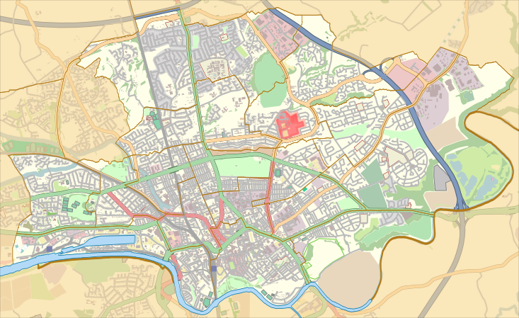
English: Map of the unparished area of en:Preston, Lancashire, England, from April 2012.
Equirectangular map projection on WGS 84 datum, with N/S stretched 165% Geographic limits:
|
| التاريخ | |
| المصدر |
هذا الملفُّ مُشتقٌ مِن : Preston UK ward map 2010 (blank).svg:
|
| المؤلف |
|
.svg)
ترخيص
| يحتوي على بيانات خريطة مساهمي خريطة الشارع المفتوحة، التي تكون متاحة بموجب شروط رخصة قاعدة بيانات حرة (ODbL).
لا تتطلب رخصة قاعدة البيانات الحرة أي ترخيص معين للخرائط المنتجة من بيانات رخصة قاعدة البيانات الحرة; إن تراكيب الخرائط التي تنتجها مؤسسة خريطة الشارع المفتوحة مرخصة بموجب الترخيص CC-BY-SA-2.0، ولكن الخرائط التي ينتجها أشخاص آخرون قد تخضع لرخص أخرى. |
هذا الملفُّ مُرخَّصٌ برخصة المشاع الإبداعي الدَّوليَّة المُلزِمة بنسب العمل إلى مُؤَلِّفه وبترخيص المُشتقَّات بالمثل 4.0.
نسب العمل لمُؤَلِّفه: Nilfanion and Dr Greg. © OpenStreetMap contributors. Contains Ordnance Survey data © Crown copyright and database right 2012.
- يحقُّ لك:
- مشاركة العمل – نسخ العمل وتوزيعه وبثُّه
- إعادة إنتاج العمل – تعديل العمل
- حسب الشروط التالية:
- نسب العمل إلى مُؤَلِّفه – يلزم نسب العمل إلى مُؤَلِّفه بشكل مناسب وتوفير رابط للرخصة وتحديد ما إذا أجريت تغييرات. بالإمكان القيام بذلك بأية طريقة معقولة، ولكن ليس بأية طريقة تشير إلى أن المرخِّص يوافقك على الاستعمال.
- الإلزام بترخيص المُشتقات بالمثل – إذا أعدت إنتاج المواد أو غيرت فيها، فيلزم أن تنشر مساهماتك المُشتقَّة عن الأصل تحت ترخيص الأصل نفسه أو تحت ترخيص مُتوافِقٍ معه.
تاريخ الملف
اضغط على زمن/تاريخ لرؤية الملف كما بدا في هذا الزمن.
| زمن/تاريخ | صورة مصغرة | الأبعاد | مستخدم | تعليق | |
|---|---|---|---|---|---|
| حالي | 22:53، 26 نوفمبر 2015 | | 733 × 449 (5٫86 ميجابايت) | Dr Greg | User created page with UploadWizard |
استخدام الملف
الصفحتان التاليتان تستخدمان هذا الملف:
الاستخدام العالمي للملف
الويكيات الأخرى التالية تستخدم هذا الملف:
- الاستخدام في en.wikipedia.org
- Preston, Lancashire
- Deepdale
- Moor Park, Preston
- Royal Preston Hospital
- Deepdale railway station
- Cadley, Lancashire
- Preston College
- Ribbleton railway station
- Ashton-on-Ribble
- Deepdale Street railway station
- Ashton Park
- Avenham
- Ribbleton
- Brookfield, Preston
- Tulketh
- Riversway
- Deepdale, Preston
- Greyfriars, Preston
- Sharoe Green
- St George's, Preston
- Larches, Preston
- College (Preston ward)
- St Matthew's, Preston
- Transport in Preston
- Tulketh Hall
- St Andrew's Church, Ashton-on-Ribble
- St Michael and All Angels Church, Ashton-on-Ribble
- St Mary Magdalene's Church, Ribbleton
- Fernyhalgh Wood
- Christ Church, Fulwood
- Church of St Thomas of Canterbury and the English Martyrs, Preston
- Fulwood Barracks
- St Mary's Church, Preston
- St Joseph's Church, Preston
- St Thomas' Church, Preston
- Module:Location map/data/United Kingdom Preston
- Module:Location map/data/United Kingdom Preston/doc
- Emmanuel Church, Preston
- Moor Park Methodist Church
- St Luke's Church, Preston
- Preston Royal Infirmary
- Kimberley Barracks
- الاستخدام في si.wikipedia.org