ملف:La2-demis-malaren.png
حجم هذه المعاينة: 800 × 408 بكسل. الأبعاد الأخرى: 320 × 163 بكسل | 640 × 326 بكسل | 991 × 505 بكسل.
الملف الأصلي (991 × 505 بكسل حجم الملف: 91 كيلوبايت، نوع MIME: image/png)
| هذا ملف من ويكيميديا كومنز. معلومات من صفحة وصفه مبينة في الأسفل. كومنز مستودع ملفات ميديا ذو رخصة حرة. |
ملخص
| الوصف |
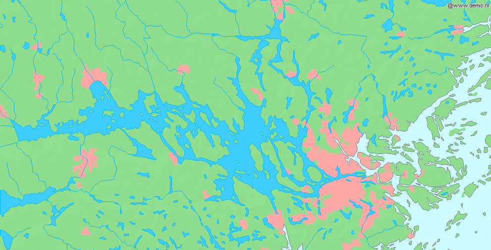
English: Lake Mälaren in Sweden.
Bounding box West 16°, South 59.1°, East 18.9°, North 59.85°. Center at 59°28′30″N 17°27′00″E / 59.47500°N 17.45000°E.Deutsch: Der Mälaren in Schweden.
Esperanto: La lago Mälaren en Svedio. |
| التاريخ | |
| المصدر | Demis map server |
| المؤلف | Demis map server |
This image is in the public domain because it came from the site https://www.demis.nl/products/web-map-server/examples/ and was released by the copyright holder. Permission is granted to copy, distribute and/or modify this map since it is based on free of copyright images from: www.demis.nl. See also approval email on de.wp and its clarification.
|
| This work has been released into the public domain by its copyright holder, www.demis.nl. This applies worldwide. في بعض البلدان، قد يكون هذا التَّرخيص غيرَ مُمكنٍ قانونيَّاً، في هذه الحالة: يمنح www.demis.nl الجميع حق استخدام هذا العمل لأي غرض دون أي شرط ما لم يفرض القانون شروطًا إضافية.
|
تاريخ الملف
اضغط على زمن/تاريخ لرؤية الملف كما بدا في هذا الزمن.
| زمن/تاريخ | صورة مصغرة | الأبعاد | مستخدم | تعليق | |
|---|---|---|---|---|---|
| حالي | 11:48، 30 أغسطس 2005 | | 991 × 505 (91 كيلوبايت) | LA2 | Lake Mälaren in Sweden. {{demis-pd}} category:Maps of Sweden |
استخدام الملف
الصفحتان التاليتان تستخدمان هذا الملف:
الاستخدام العالمي للملف
الويكيات الأخرى التالية تستخدم هذا الملف:
- الاستخدام في bg.wikipedia.org
- الاستخدام في cs.wikipedia.org
- الاستخدام في da.wikipedia.org
- الاستخدام في en.wikipedia.org
- الاستخدام في eo.wikipedia.org
- الاستخدام في et.wikipedia.org
- الاستخدام في fr.wikipedia.org
- الاستخدام في id.wikipedia.org
- الاستخدام في it.wikipedia.org
- الاستخدام في no.wikipedia.org
- الاستخدام في pms.wikipedia.org
- الاستخدام في pt.wikipedia.org
- الاستخدام في sk.wikipedia.org
- الاستخدام في sv.wikipedia.org
- الاستخدام في uk.wikipedia.org
- الاستخدام في vi.wikipedia.org