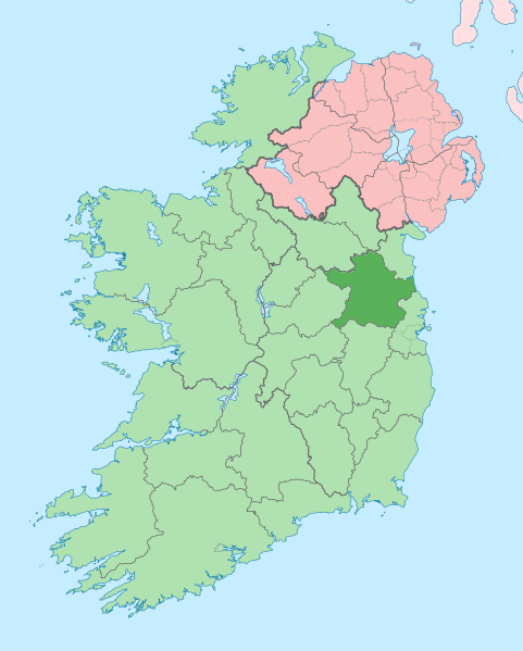
ملف:Island of Ireland location map Meath.svg

حجم معاينة PNG لذلك الملف ذي الامتداد SVG: 481 × 599 بكسل. الأبعاد الأخرى: 192 × 240 بكسل | 385 × 480 بكسل | 616 × 768 بكسل | 822 × 1٬024 بكسل | 1٬643 × 2٬048 بكسل | 1٬450 × 1٬807 بكسل.
الملف الأصلي (ملف SVG، أبعاده 1٬450 × 1٬807 بكسل، حجم الملف: 642 كيلوبايت)
تاريخ الملف
اضغط على زمن/تاريخ لرؤية الملف كما بدا في هذا الزمن.
| زمن/تاريخ | صورة مصغرة | الأبعاد | مستخدم | تعليق | |
|---|---|---|---|---|---|
| حالي | 09:16، 3 يوليو 2020 |  | 1٬450 × 1٬807 (642 كيلوبايت) | Chipmunkdavis | Per the Local Government Reform Act 2014, joining both Tipperarys and both Waterfords (and removing Limerick City code). Colouring in islands, cleaning up and grouping code to remove stray objects and show Galway and Lough Ree. |
| 01:00، 19 يوليو 2010 |  | 1٬450 × 1٬807 (815 كيلوبايت) | Mabuska | {{Information |Description={{en|The island of Ireland, showing international border between Northern Ireland and Republic of Ireland, traditional provinces, traditional counties, and local authority areas in the Republic of Ireland and Northern Ireland.}} |
استخدام الملف
الصفحة التالية تستخدم هذا الملف:
الاستخدام العالمي للملف
الويكيات الأخرى التالية تستخدم هذا الملف:
- الاستخدام في ast.wikipedia.org
- الاستخدام في bg.wikipedia.org
- الاستخدام في ca.wikipedia.org
- الاستخدام في ceb.wikipedia.org
- الاستخدام في cs.wikipedia.org
- الاستخدام في da.wikipedia.org
- الاستخدام في de.wikivoyage.org
- الاستخدام في en.wikipedia.org
- Slane
- County Meath
- Trim, County Meath
- List of Ireland-related topics
- Navan
- Kells, County Meath
- Julianstown
- Oldcastle, County Meath
- Carnaross
- Kiltale
- Dunshaughlin
- Duleek
- Faughan Hill
- Moynalty
- Ratoath
- Ráth Chairn
- Skryne
- Nobber
- Dunboyne
- Durhamstown Castle
- 2005 Meath by-election
- Loch Gabhar
- Ardcath
- Monknewtown
- Butlin's Mosney
- Laytown
- Curraha
اعرض المزيد من الاستخدام العام لهذا الملف.