ملف:Island of Ireland location map Dublin.svg

حجم معاينة PNG لذلك الملف ذي الامتداد SVG: 481 × 599 بكسل. الأبعاد الأخرى: 192 × 240 بكسل | 385 × 480 بكسل | 616 × 768 بكسل | 822 × 1٬024 بكسل | 1٬643 × 2٬048 بكسل | 1٬450 × 1٬807 بكسل.
الملف الأصلي (ملف SVG، أبعاده 1٬450 × 1٬807 بكسل، حجم الملف: 642 كيلوبايت)
| هذا ملف من ويكيميديا كومنز. معلومات من صفحة وصفه مبينة في الأسفل. كومنز مستودع ملفات ميديا ذو رخصة حرة. |
| الوصف |
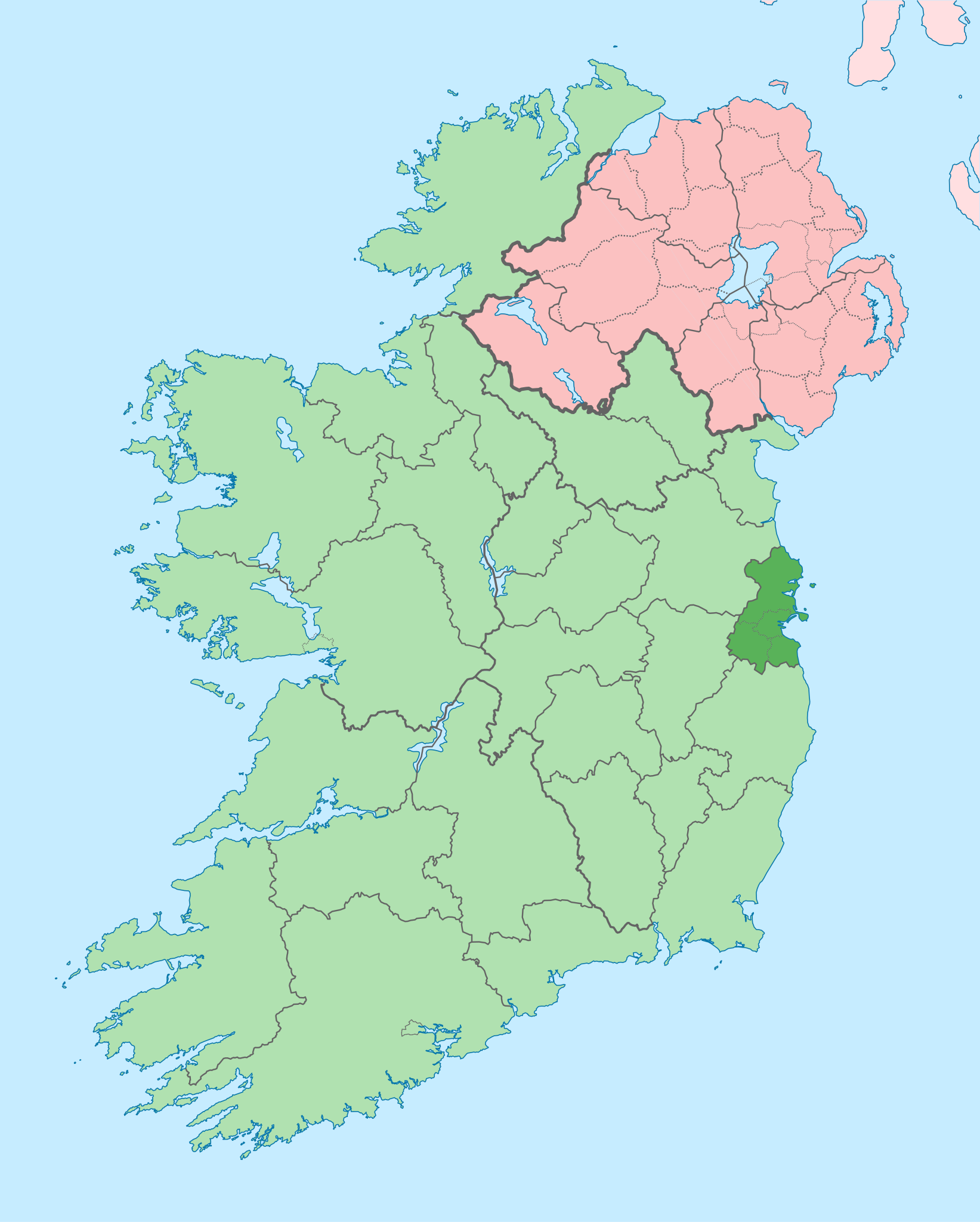
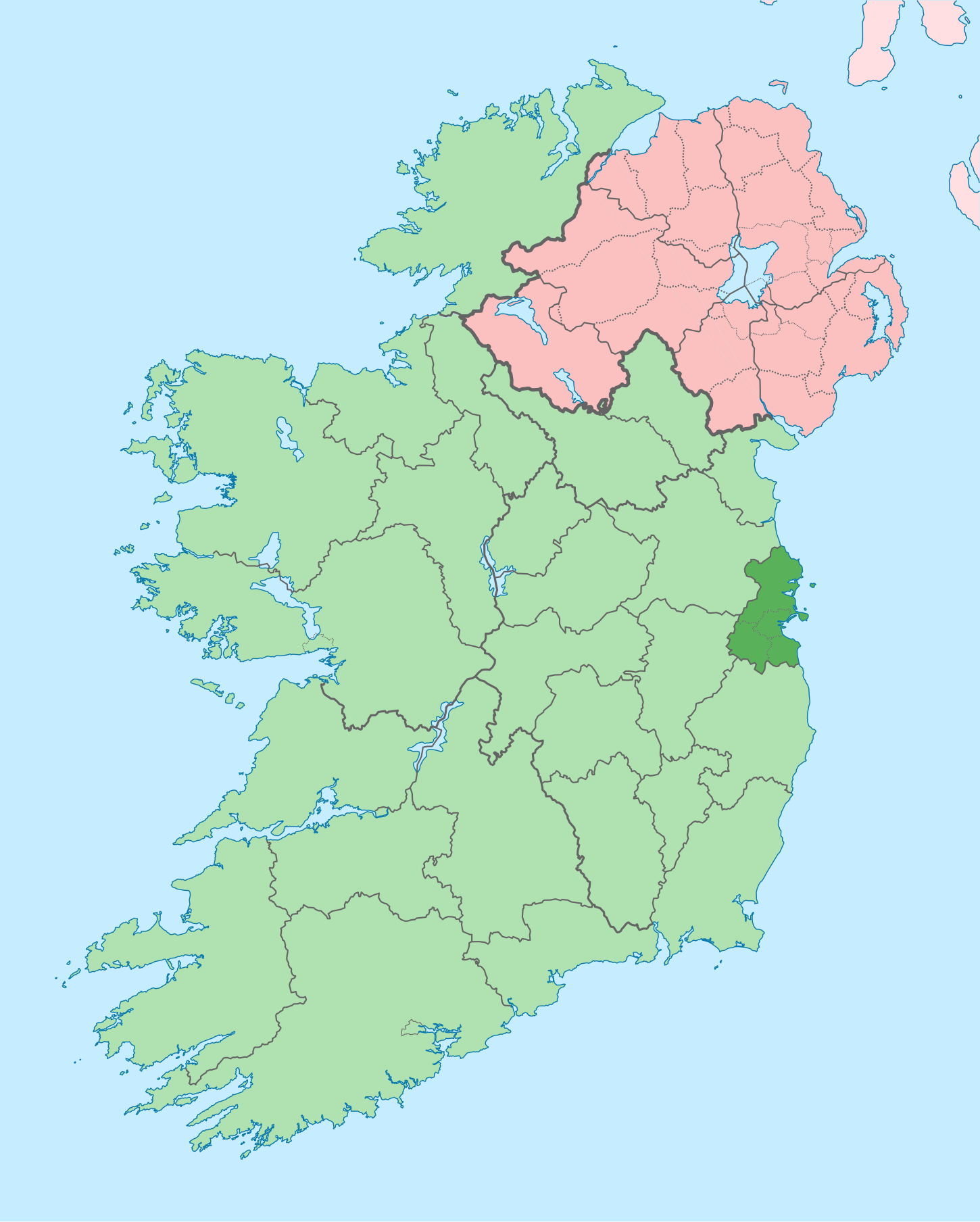
English: The island of Ireland, showing international border between Ireland and Northern Ireland, traditional provinces, traditional counties, and local authority areas in Ireland and Northern Ireland. |
| التاريخ | (UTC) |
| المصدر | |
| المؤلف |
|
| إصدارات أخرى |
أَعمالٌ مُشتقَّة مِن هذا الملفِّ: |
| هذا رسمٌ مُعَدَّلٌ رقميَّاً من النسخة الأصليَّة. التعديلات هي: Coloured in regions with county of article highlighted. يُمكن الاطلاع على النسخة الأصليَّة هنا: Island of Ireland location map.svg:
|
أنا، صاحب حقوق التأليف والنشر لهذا العمل، أنشر هذا العمل تحت الرخصة التالية:
هذا الملفُّ مُرخَّص بموجب رخصة المشاع الإبداعي نسبة المُصنَّف إِلى مُؤَلِّفه - المشاركة بالمثل 3.0 العامة
- يحقُّ لك:
- مشاركة العمل – نسخ العمل وتوزيعه وبثُّه
- إعادة إنتاج العمل – تعديل العمل
- حسب الشروط التالية:
- نسب العمل إلى مُؤَلِّفه – يلزم نسب العمل إلى مُؤَلِّفه بشكل مناسب وتوفير رابط للرخصة وتحديد ما إذا أجريت تغييرات. بالإمكان القيام بذلك بأية طريقة معقولة، ولكن ليس بأية طريقة تشير إلى أن المرخِّص يوافقك على الاستعمال.
- الإلزام بترخيص المُشتقات بالمثل – إذا أعدت إنتاج المواد أو غيرت فيها، فيلزم أن تنشر مساهماتك المُشتقَّة عن الأصل تحت ترخيص الأصل نفسه أو تحت ترخيص مُتوافِقٍ معه.
سجلُّ الرَّفع الأصيل
This image is a derivative work of the following images:
- File:Island_of_Ireland_location_map.svg licensed with Cc-by-sa-3.0
- 2010-03-06T20:43:33Z Rannpháirtí anaithnid 1450x1807 (679207 Bytes) Fix incorrectly coloured isands.
- 2010-03-03T22:19:29Z Rannpháirtí anaithnid 1450x1807 (679744 Bytes) {{Information |Description={{de|Positionskarte von [[:de:Irland|Irland]]}} Quadratische Plattkarte, N-S-Streckung 170 %. Geographische Begrenzung der Karte: * N: 55.6° N * S: 51.2° N * W: 11.0° W * O: 5.0° W {{en|Location
Uploaded with derivativeFX
تاريخ الملف
اضغط على زمن/تاريخ لرؤية الملف كما بدا في هذا الزمن.
| زمن/تاريخ | صورة مصغرة | الأبعاد | مستخدم | تعليق | |
|---|---|---|---|---|---|
| حالي | 09:16، 3 يوليو 2020 | | 1٬450 × 1٬807 (642 كيلوبايت) | Chipmunkdavis | Per the Local Government Reform Act 2014, joining both Tipperarys and both Waterfords (and removing Limerick City code). Colouring in islands, cleaning up and grouping code to remove stray objects and show Galway and Lough Ree. |
| 00:44، 19 يوليو 2010 |  | 1٬450 × 1٬807 (815 كيلوبايت) | Mabuska | {{Information |Description={{en|The island of Ireland, showing international border between Northern Ireland and Republic of Ireland, traditional provinces, traditional counties, and local authority areas in the Republic of Ireland and Northern Ireland.}} |
استخدام الملف
الصفحة التالية تستخدم هذا الملف:
الاستخدام العالمي للملف
الويكيات الأخرى التالية تستخدم هذا الملف:
- الاستخدام في ast.wikipedia.org
- الاستخدام في bg.wikipedia.org
- الاستخدام في ca.wikipedia.org
- الاستخدام في cs.wikipedia.org
- الاستخدام في da.wikipedia.org
- الاستخدام في en.wikipedia.org
- County Dublin
- Dublin
- Swords, Dublin
- Sydney Parade Avenue
- Northside, Dublin
- Southside, Dublin
- Merrion Centre, Dublin
- List of Ireland-related topics
- South Dublin
- Dún Laoghaire–Rathdown
- Fingal
- Template:County Dublin
- Tallaght
- List of Dublin postal districts
- Shenick Island
- Park Avenue, Dublin
- Kilmore West
- Greater Dublin Area
- Nutgrove
- Sutton Park, Dublin
- Man of War, Fingal
- Template:Dublin-geo-stub
- Heytesbury Street
- N32 road (Ireland)
- History of Belfast
- List of subdivisions of County Dublin
- North Wall, Dublin
- Sutton Creek (Ireland)
- Glenview, Tallaght
- Shandon, Dublin
- Ashtown Castle
- Red Gap
- Sandymount Avenue
اعرض المزيد من الاستخدام العام لهذا الملف.