ملف:Bayou des Allemands.jpg
حجم هذه المعاينة: 800 × 533 بكسل. الأبعاد الأخرى: 320 × 213 بكسل | 640 × 427 بكسل | 1٬024 × 683 بكسل | 1٬500 × 1٬000 بكسل.
الملف الأصلي (1٬500 × 1٬000 بكسل حجم الملف: 333 كيلوبايت، نوع MIME: image/jpeg)
| هذا ملف من ويكيميديا كومنز. معلومات من صفحة وصفه مبينة في الأسفل. كومنز مستودع ملفات ميديا ذو رخصة حرة. |
| الوصف |
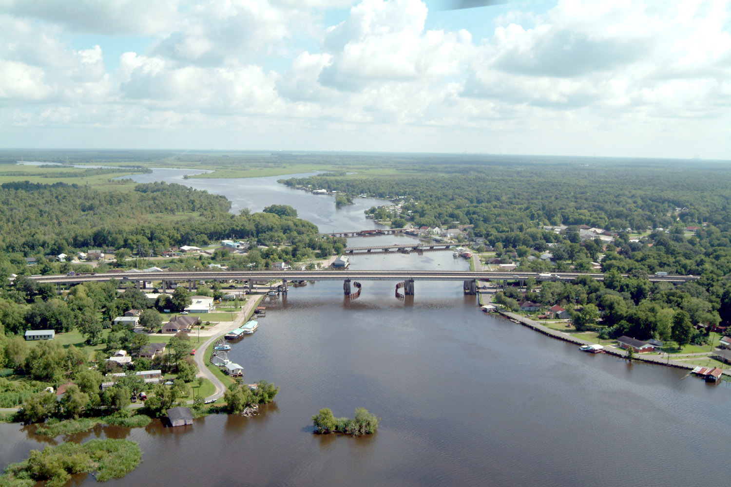
English: Bayou des Allemands and the town of Des Allemands, Louisiana, USA. The bayou is the boundary between St. Charles Parish (right) and Lafourche Parish (left). The three bridges crossing the bayou are (farthest to closest): A railroad bridge, Louisiana State Route 631, and U.S. Route 90. View is to the north. |
|||
| التاريخ | ||||
| المصدر |
U.S. Army Corps of Engineers Digital Visual Library Image page Image description page Digital Visual Library home page |
|||
| المؤلف | Lane Lefort, U.S. Army Corps of Engineers | |||
| الترخيص (إعادة استخدام هذا الملف) |
|
|||
| الموقع | Des Allemands, Louisiana, USA |
| موقع آلة التصوير | | هذه وغيرها من الصور في مواقعها على: خريطة الشارع المفتوحة |
|---|
تاريخ الملف
اضغط على زمن/تاريخ لرؤية الملف كما بدا في هذا الزمن.
| زمن/تاريخ | صورة مصغرة | الأبعاد | مستخدم | تعليق | |
|---|---|---|---|---|---|
| حالي | 22:41، 7 أبريل 2007 | | 1٬500 × 1٬000 (333 كيلوبايت) | DanMS | {{Information | Description = {{en|Bayou des Allemands and the town of Des Allemands, Louisiana, USA. The bayou is the boundary between St. Charles Parish (right) and Lafourche Parish (left). The three bridges crossing the bayou are (farthest to closes |
استخدام الملف
الصفحة التالية تستخدم هذا الملف:
الاستخدام العالمي للملف
الويكيات الأخرى التالية تستخدم هذا الملف:
- الاستخدام في ca.wikipedia.org
- الاستخدام في ceb.wikipedia.org
- الاستخدام في ce.wikipedia.org
- الاستخدام في cy.wikipedia.org
- الاستخدام في de.wikipedia.org
- الاستخدام في en.wikipedia.org
- الاستخدام في es.wikipedia.org
- الاستخدام في fa.wikipedia.org
- الاستخدام في fr.wikipedia.org
- الاستخدام في fy.wikipedia.org
- الاستخدام في it.wikipedia.org
- الاستخدام في lld.wikipedia.org
- الاستخدام في nl.wikipedia.org
- الاستخدام في pl.wikipedia.org
- الاستخدام في pt.wikipedia.org
- الاستخدام في sh.wikipedia.org
- الاستخدام في sr.wikipedia.org
- الاستخدام في th.wikipedia.org
- الاستخدام في tt.wikipedia.org
- الاستخدام في uk.wikipedia.org
- الاستخدام في www.wikidata.org
- الاستخدام في zh-min-nan.wikipedia.org
- الاستخدام في zh.wikipedia.org