ملف:Batsirai 2022-02-02 0250Z-1415Z.gif
حجم هذه المعاينة: 800 × 600 بكسل. الأبعاد الأخرى: 320 × 240 بكسل | 640 × 480 بكسل | 1٬024 × 768 بكسل | 1٬280 × 960 بكسل.
الملف الأصلي (1٬280 × 960 بكسل حجم الملف: 10٫85 ميجابايت، نوع MIME: image/gif، ملفوف، 34 إطارا، 17ث)
| هذا ملف من ويكيميديا كومنز. معلومات من صفحة وصفه مبينة في الأسفل. كومنز مستودع ملفات ميديا ذو رخصة حرة. |
ملخص
| الوصف |
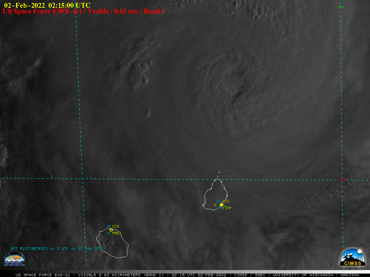
English: US Space Force EWS-G1 (formerly GOES-13) Infrared Window (10.7 µm) images (above) showed Cyclone Batsirai in the South Indian Ocean — just north of the island nations of Mauritius and Réunion — during the time period it was classified as a Category 4 intensity storm (00 UTC on 02 February to 15 UTC on 03 February 2022). Note that the small-diameter eye became notably larger by the end of the animation. |
| التاريخ | |
| المصدر | https://cimss.ssec.wisc.edu/satellite-blog/?s=Cyclone+Batsirai |
| المؤلف | Cooperative Institute for Meteorological Satellite Studies |
ترخيص
This image was produced by the SSEC/CIMSS, University of Wisconsin–Madison. All the images published on their website can be freely used, as long as the source is acknowledged. (disclaimer (archive))
|
 |

تاريخ الملف
اضغط على زمن/تاريخ لرؤية الملف كما بدا في هذا الزمن.
| زمن/تاريخ | صورة مصغرة | الأبعاد | مستخدم | تعليق | |
|---|---|---|---|---|---|
| حالي | 06:07، 4 فبراير 2022 | | 1٬280 × 960 (10٫85 ميجابايت) | HurricaneEdgar | Uploaded a work by {{label|Q2996587}} from https://cimss.ssec.wisc.edu/satellite-blog/?s=Cyclone+Batsirai with UploadWizard |
استخدام الملف
الصفحة التالية تستخدم هذا الملف:
الاستخدام العالمي للملف
الويكيات الأخرى التالية تستخدم هذا الملف:
- الاستخدام في en.wikipedia.org
- الاستخدام في fr.wikipedia.org
- الاستخدام في pt.wikipedia.org