ملف:Aerial view of Nauru.jpg
حجم هذه المعاينة: 800 × 587 بكسل. الأبعاد الأخرى: 320 × 235 بكسل | 640 × 469 بكسل | 1٬024 × 751 بكسل | 1٬280 × 938 بكسل | 1٬600 × 1٬173 بكسل.
الملف الأصلي (1٬600 × 1٬173 بكسل حجم الملف: 545 كيلوبايت، نوع MIME: image/jpeg)
| هذا ملف من ويكيميديا كومنز. معلومات من صفحة وصفه مبينة في الأسفل. كومنز مستودع ملفات ميديا ذو رخصة حرة. |
ملخص
| الوصف |
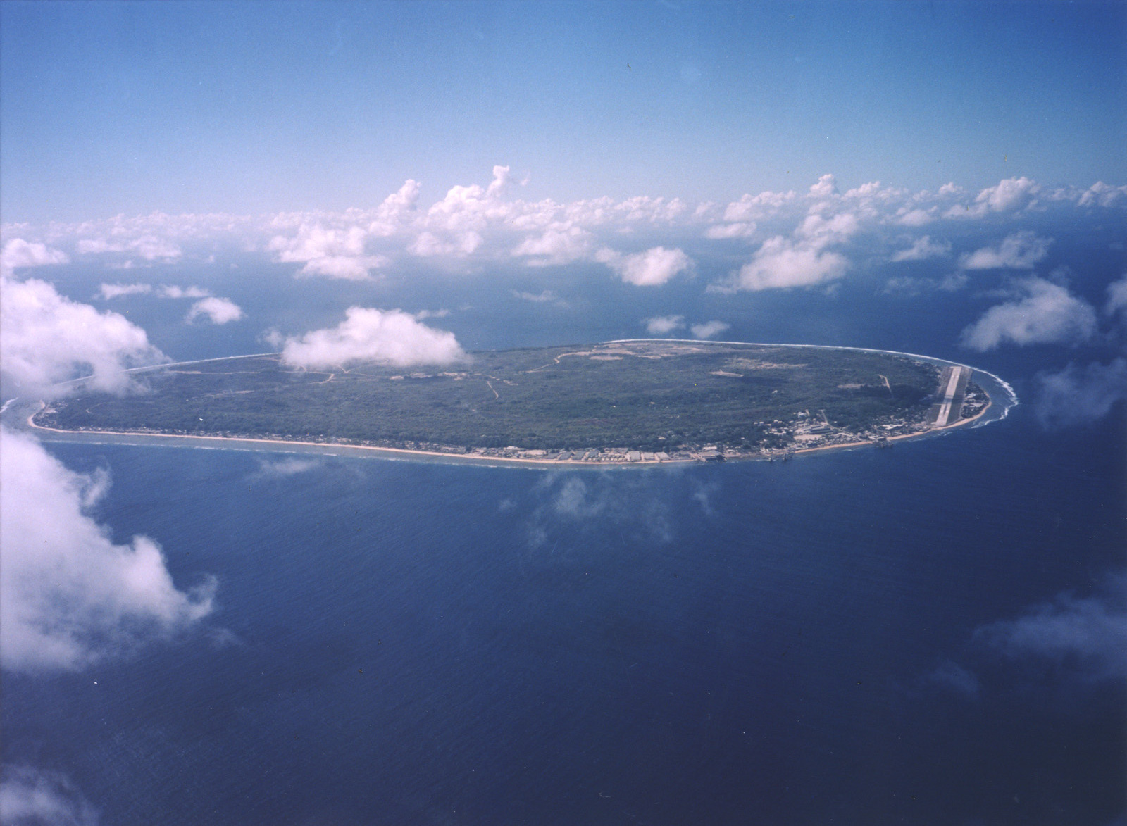
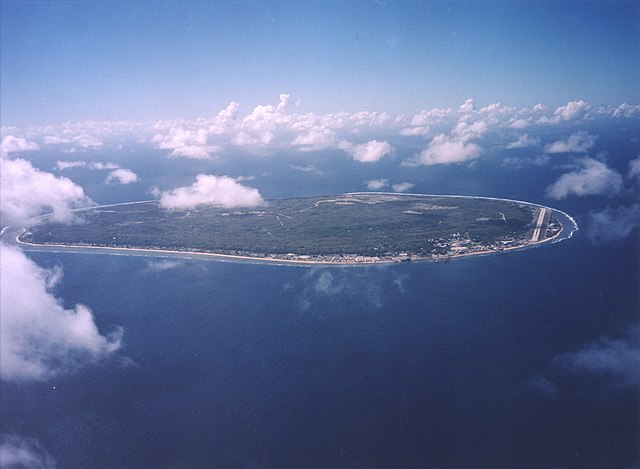
English: A limestone karst on Nauru Island as a result of the over-mining of phosphate. |
| التاريخ | |
| المصدر | https://www.flickr.com/photos/armgov/4708951747/ |
| المؤلف | U.S. Department of Energy's Atmospheric Radiation Measurement Program |
ترخيص
This photograph was produced by the Atmospheric Radiation Measurement Program.
Their site states:
|
تاريخ الملف
اضغط على زمن/تاريخ لرؤية الملف كما بدا في هذا الزمن.
| زمن/تاريخ | صورة مصغرة | الأبعاد | مستخدم | تعليق | |
|---|---|---|---|---|---|
| حالي | 22:53، 28 أبريل 2023 | | 1٬600 × 1٬173 (545 كيلوبايت) | Auguel | Cropped 1 % vertically using CropTool with lossless mode. |
| 02:13، 3 أبريل 2007 |  | 1٬600 × 1٬187 (401 كيلوبايت) | Indolences | A limestone karst on Nauru Island as a result of the over-mining of phosphate. ''Courtesy: U.S. Department of Energy's Atmospheric Radiation Measurement Program.'' Source: [http://images.arm.gov/armimages.nsf/by+id/TENG-5JGSKP] (http://www.arm.gov/) {{ |
استخدام الملف
الصفحة التالية تستخدم هذا الملف:
الاستخدام العالمي للملف
الويكيات الأخرى التالية تستخدم هذا الملف:
- الاستخدام في as.wikipedia.org
- الاستخدام في bg.wikipedia.org
- الاستخدام في de.wikipedia.org
- الاستخدام في dsb.wikipedia.org
- الاستخدام في en.wikipedia.org
- الاستخدام في en.wikiversity.org
- الاستخدام في es.wikipedia.org
- الاستخدام في fr.wikipedia.org
- الاستخدام في fr.wiktionary.org
- الاستخدام في he.wikivoyage.org
- الاستخدام في hsb.wikipedia.org
- الاستخدام في hu.wikipedia.org
- الاستخدام في hy.wikipedia.org
- الاستخدام في id.wikipedia.org
- الاستخدام في incubator.wikimedia.org
- الاستخدام في lv.wikipedia.org
- الاستخدام في ms.wikipedia.org
- الاستخدام في na.wikipedia.org
- الاستخدام في nl.wikivoyage.org
- الاستخدام في pl.wikipedia.org
- الاستخدام في pt.wikivoyage.org
- الاستخدام في ru.wikipedia.org
- الاستخدام في ru.wikivoyage.org
- الاستخدام في simple.wikipedia.org
- الاستخدام في si.wikipedia.org
- الاستخدام في ta.wikipedia.org
- الاستخدام في test.wikipedia.org
- الاستخدام في th.wikipedia.org
- الاستخدام في tr.wikipedia.org
- الاستخدام في uk.wikipedia.org
- الاستخدام في vec.wikipedia.org
- الاستخدام في vi.wikipedia.org
- الاستخدام في vi.wikivoyage.org